How Directional Drilling Works in Austin Ground
The fault line that runs the market
The Balcones fault system splits this metro into two drilling trades. West: Edwards and Glen Rose limestones — Hill Country rock, hard and karst-featured, where every bore is planned as a rock bore and voids are a written procedure. East: Taylor and Blackland clays — deep, plastic, seasonal — where drilling runs fast and the discipline is fluid manners and shrink-swell awareness. The line is sharp enough that alignments crossing it get priced as two products in one quote.
Between and beneath, the Colorado's chain of dammed reaches organizes the crossings, and the Barton Springs segment of the Edwards Aquifer south of the river adds a regulatory layer with genuine civic teeth.
The sequence, and the local bends
Standard bones: 811 locates plus private designating, potholes on every crossing utility, pilot bore on profile, reaming to roughly one and a half times product diameter, pullback, restoration. Austin bends: rock tooling staged as default kit west of the line, entry/exit benched to Hill Country grades, watershed-grade fluid containment in the regulated zones, and restoration matched to ground that ranges from bare limestone shelf to deep black clay within one county.
Water rules worth respecting
South-of-river alignments in the Barton Springs zone operate under city watershed rules and the state's Edwards Aquifer protections — for HDD, that means the fluid program is a compliance document: containment at entry and exit, monitored returns, spill response staged, void procedures written. It's also simply how you keep drilling in a town that would rather lose a road than a spring. We build those plans as the default south of the river and anywhere the recharge maps say so.
What the scope sheet asks, and why it won't show a price
The national desk behind this site has answered 50,000+ boring calls and quoted close to 10,000 crossings, and the Austin lesson is the two-ground lesson: the expensive quoting mistake here is blending rock and clay into one optimistic rate. So the scope sheet asks where the alignment runs, what ground data exists, what's going in, and what it crosses — then holds at Pending Review until a person prices the actual alignment by ground class. An instant number that ignores the fault line would be wrong twice.
Straight answers
How do I know which side of the line my project is on?
Roughly: west of MoPac and up the Hill Country shelves, plan on rock; east of I-35, plan on clay; between them, it's alignment-specific and worth a probe. Send your pins and the desk reads the geology for you — that's part of scoping, not an extra.
How deep do bores run under Austin streets?
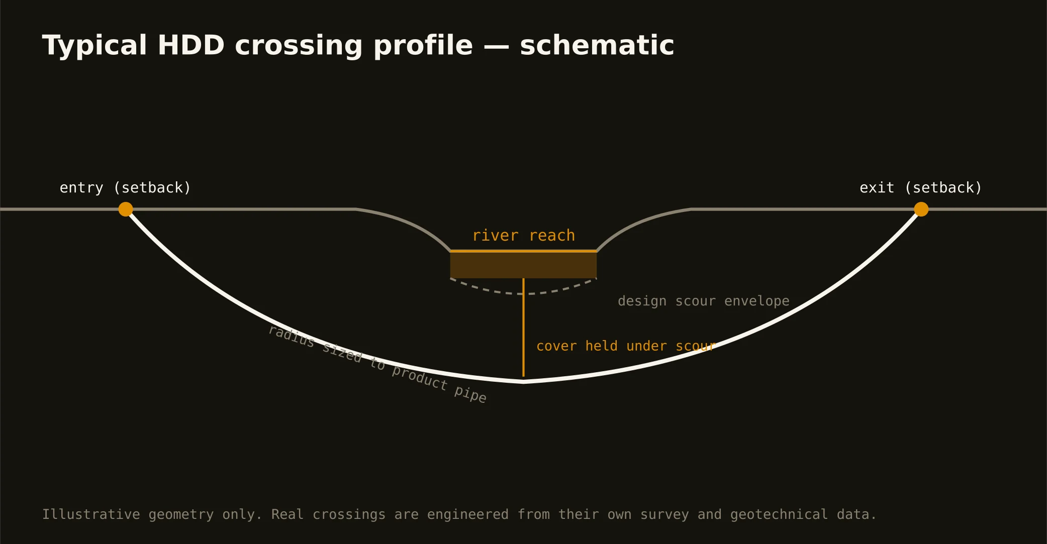
Cover follows the owning authority's standard — city, county, TxDOT accommodation rules, or a toll authority's — and sits below everything potholed on the alignment. River and rail crossings run deeper, set by scour design and the owner's engineering. The bore plan states your number.
Does limestone make bores more expensive?
Per foot, yes — tooling, pace, and wear are real. What it shouldn't make them is unpredictable: rock priced as rock up front is just a number; rock discovered inside a clay quote is a dispute. We sell the first kind.
Ready to put a number on a real crossing? Send the scope — a person prices it.